ISIS Application Documentation
maptemplate | Standard View | TOC | Home |
Create map file template for a projection
Description
Categories
Groups
Examples
History
Description
This program produces a PVL formatted file that contains the mapping group keywords required to transform an image to a map projection.
Required Input
- Map File Template output filename
- Projection name
- Additional parameters required for specific projections
- Input list if CALC option will be used
Output
A PVL formatted Map File Template containing mapping group keywords
for the selected projection. The '.map' extension is appended to the output
file automatically, if the file extension is not provided by the user. The
output file may contain all or some of the map specifications listed below:
- User-preferred projection type (required)
- Other keywords required for specific projections
- Target body radii
- Latitude/longitude coverage or ground range
- Pixel resolution
- Latitude and longitude definitions
- Distance from center of target
- Standard parallels
Map File Template Creation
To convert a raw instrument/camera cube (Level1) to a map projected
image (Level2) the user must (1) create a custom PVL formatted
text file, (2) use this maptemplate application to produce one, or (3) use
the automated, projection-specific Map File Template in $ISISROOT/templates/appdata/maps.
Whichever method that you choose, the Map File Template should contain the necessary
keywords to project an image.
Map File Template Creation Choices:
-
PVL formatted text file: you must make a list of parameters
based on the projection you wish to use, and input the appropriate values
for each. The following example is a custom Map File Template for defining
the projection of an image of Mars to the sinusoidal projection:
 Group = Mapping
 TargetName         = Mars
 EquatorialRadius   = 3396190.0 <meters>
 PolarRadius        = 3376200.0 <meters>
 LatitudeType       = Planetocentric
 LongitudeDirection = PositiveEast
 LongitudeDomain    = 360

 ProjectionName     = Sinusoidal
 CenterLongitude    = 227.95679808356

 MinimumLatitude    = 10.766902750622
 MaximumLatitude    = 34.44419678224
 MinimumLongitude   = 219.7240455337
 MaximumLongitude   = 236.18955063342

 PixelResolution    = 426.87763879023 <meters/pixel>
 End_Group
The example above contains both required and optional keywords. -
The maptemplate application: maptemplate will prompt you for
all the necessary parameters to project your image. However, the planar and
ring cylindrical projections are excluded from use in the application, because
it requires keywords that are not defined in the program.
-
Templates in $ISISROOT/templates/appdata/maps: the template contains all the
parameters necessary to project an image, and only the Projection name is
"uncommented" in the file. This is because some projections only require
that you enter a projection name, and the default values are computed for
the remaining keywords. In such cases where the default value cannot be
calculated using the camera model or ISIS system default, you must
"uncomment" the appropriate line(s) of the template and set the values.
See example below:
Group = Mapping
  ProjectionName  = LambertConformal
# CenterLatitude  = 0.0 <degrees>
# CenterLongitude = 0.0 <degrees>
# Earth (ographic)
# FirstStandardParallel  = 33.0 <degrees>
# SecondStandardParallel = 45.0 <degrees>

# Mars (ographic)
# FirstStandardParallel  = 35.83 <degrees>  *Remove # to uncomment and change 35.83 to your value
# SecondStandardParallel = 59.17 <degrees>  *Remove # to uncomment and change 59.17 to your value
  End_Group
Identifying Required Parameters:
The following is a list of projections and keywords that are required. When
a keyword is missing, and you try to project an image using projection
software like cam2map, an error will occur. Below is a list of
projections and the keywords that must be in the Map File Template:
| PROJECTION | ASSIGN VALUES FOR THESE KEYWORDS |
|---|---|
| Lambert Conformal | FirstStandardParallel, SecondStandardParallel |
| Oblique cylindrical | PoleLatitude, PoleLongitude, PoleRotation |
| Point perspective | Distance |
| Planar (unavailable in maptemplate) | CenterRingRadius, CenterRingLongitude, RingLongitudeDirection, RingLongitudeDomain |
| Ring cylindrical (unavailable in maptemplate) | CenterRingRadius, CenterRingLongitude, RingLongitudeDirection, RingLongitudeDomain |
How the defaults are set for Mapping Group keywords:
| DEFAULT SOURCE | MAPPING GROUP KEYWORDS |
|---|---|
| From Label | TargetName |
| From camera model | CenterLatitude, CenterLongitude, MaximumLatitude, MaximumLongitude, MinimumLatitude, MinimumLongitude, PixelResolution, Scale |
| ISIS Map defaults | LatitudeType (ocentric), LongitudeDomain (360), LongitudeDirection (East), ScaleFactor (1) |
| From PCK file for Target | EquatorialRadius, PolarRadius |
| Not computed, user must set | CenterRingLongitude, CenterRingRadius, Distance, FirstStandardParallel, MaximumRingLongitude, MaximumRingRadius, MinimumRingLongitude, MinimumRingRadius, PoleLatitude, PoleLongitude, PoleRotation, RingLongitudeDirection, RingLongitudeDomain, SecondStandardParallel |
Maptemplate GUI Interface
Radio buttons in the GUI are used to select options. Once an option is
selected, the required parameters pertinent to that option become activated;
therefore the user should complete the highlighted fields in the different
parameter sections. Use the right scroll bar on the right side of the GUI
to see all the available options.
The
Parameter Setting Action
| PARAMETER | ACTION |
|---|---|
| NONE | No keywords regarding the target will be added to the Map File Template. The value for the required keywords is derived based on the ISIS defaults at the time of projection. If a target name is specified and no value is entered for radius, the system radii will be used. |
| USER | The user must enter the target and the preferred settings for the selected projection. The user can select meters per pixel (MPP) or pixels per degree (PPD) to define the units for the value entered for Resolution. If MPP is chosen, the value is set for the keyword PixelResolution. If PPD is chosen, the value is set for the keyword Scale. |
| SELECT | The target definition information is retrieved from an existing Map File Template. The information can be displayed in the log area or loaded into appropriate GUI fields. The Help buttons located by the radial fields can only be used when the GUI is used to specify the parameters. |
| CALC | The application maptemplate will calculate the values using the files in the input list specified in the FROMLIST parameter. For the ground range, the keywords MinimumLatitude, MaximumLatitude, MinimumLongitude, and MaximumLongitude are set. The values for ground range are in degrees. For the resolution, the keywords PixelResolution and Scale are set. All the calculated values for resolution will be meters per pixel for the keyword PixelResolution. |
| RESCALCOPT | The PixelResolution value is set based on whether the user selected HIGH, LOW, or AVERAGE when the CALC option is used to calculate the resolution. |
Other Uses for Your Created Map file: The output Map File can be used in applications that use projections, such as cam2map, map2map, mapsize, skymap, and more.
See "Learning About Map Projections" to learn more about mapping keywords.
Categories
Related Objects and Documents
Applications
Parameter Groups
Files
| Name | Description |
|---|---|
| MAP | Output text file containing mapping keywords and values |
| FROMLIST | Input list of images used when calculation option is selected |
Projection
| Name | Description |
|---|---|
| PROJECTION | Projection selection for the map file |
Projection Parameters
| Name | Description |
|---|---|
| CLON | Center Longitude |
| CLAT | Center Latitude |
| SCALEFACTOR | Scale Factor |
| PAR1 | First Standard Parallel |
| PAR2 | Second Standard Parallel |
| PLAT | Pole Latitude |
| PLON | Pole Longitude |
| PROT | Pole Rotation |
| DIST | Distance from the center of the target in kilometers. |
Target Parameters
| Name | Description |
|---|---|
| TARGOPT | Target Selection Options |
| FILE | Name of the Map File |
| TARGETNAME | Name of the Target |
| LATTYPE | Latitude type |
| LONDIR | Longitude Direction |
| LONDOM | Longitude Domain |
| EQRADIUS | Equatorial Radius |
| POLRADIUS | Polar Radius |
Ground Range Parameters
| Name | Description |
|---|---|
| RNGOPT | Ground Range Selection Options |
| MINLAT | Minimum Latitude |
| MAXLAT | Maximum Latitude |
| MINLON | Minimum Longitude |
| MAXLON | Maximum Longitude |
Resolution Parameters
| Name | Description |
|---|---|
| RESOPT | Resolution Selection Options |
| RESOLUTION | Resolution |
| RESCALCOPT | Calculated Resolution Selection Options |
Files: MAP
Description
This file will contain the mapping information for a projection. If this file currently exists, the application overwrites the file. The '.map' extension will automatically append to the filename entered if you do not type in an extension. If the file name in the GUI field does not have the extension, add ".map" to the string before pressing the button to display the contents.
| Type | filename |
|---|---|
| File Mode | output |
| Filter | *.map *.cub |
Files: FROMLIST
Description
A list of file names that will be used to calculate the values when (CALC) option is selected for the ground range (RNGOPT) or resolution (RESOPT) parameters. It is also used when a user selects the help button for the two parameters.
| Type | filename |
|---|---|
| File Mode | input |
| Internal Default | Input list that is used only when CALC option is invoked |
| Filter | *.lis |
Projection: PROJECTION
Description
This is the name of the projection for the map file being created. The maptemplate application currently does not support Planar and Ring Cylindrical projections.
| Type | string | |||||||||||||||||||||||||||||||||||||||
|---|---|---|---|---|---|---|---|---|---|---|---|---|---|---|---|---|---|---|---|---|---|---|---|---|---|---|---|---|---|---|---|---|---|---|---|---|---|---|---|---|
| Default | SINUSOIDAL | |||||||||||||||||||||||||||||||||||||||
| Option List: |
|
Projection Parameters: CLON
Description
The center longitude to use for the mapping group.
| Type | double |
|---|
Projection Parameters: CLAT
Description
The center latitude to use for the mapping group.
| Type | double |
|---|
Projection Parameters: SCALEFACTOR
Description
The scale factor to use for the mapping group.
| Type | double |
|---|
Projection Parameters: PAR1
Description
The first standard parallel to use for the mapping group.
| Type | double |
|---|
Projection Parameters: PAR2
Description
The second standard parallel to use for the mapping group.
| Type | double |
|---|
Projection Parameters: PLAT
Description
The pole latitude to use for the mapping group.
| Type | double |
|---|
Projection Parameters: PLON
Description
The pole longitude to use for the mapping group.
| Type | double |
|---|
Projection Parameters: PROT
Description
The pole rotation to use for the mapping group.
| Type | double |
|---|
Projection Parameters: DIST
Description
Distance from the center of the target in kilometers: value should be greater than the target radius.
| Type | double |
|---|
Target Parameters: TARGOPT
Description
This option specifies how the target information will be created. The default is NONE. The other options are SELECT and USER. The NONE option will not add any target information to the map file, allowing the target information from the image to be used. The SELECT option allows the user to select an existing file with mapping group, and load the target loaded information in the GUI fields. The target information is written to the output file. The USER option allows the user to specify their target information.
| Type | string | ||||||||||||
|---|---|---|---|---|---|---|---|---|---|---|---|---|---|
| Default | NONE | ||||||||||||
| Option List: |
|
Target Parameters: FILE
Description
This is the Map File Template that is used to set the target specific values in the mapping group for the projection.
| Type | filename |
|---|---|
| Filter | *.map *.txt *.def *.pvl *.cub |
Target Parameters: TARGETNAME
Description
This is the name of the Target (your planet of interest) for the projection.
| Type | string |
|---|
Target Parameters: LATTYPE
Description
The latitude type for the projection. It can either be Planetocentric or Planetographic. PLANETOCENTRIC is the default.
| Type | string | |||||||||
|---|---|---|---|---|---|---|---|---|---|---|
| Default | PLANETOCENTRIC | |||||||||
| Option List: |
|
Target Parameters: LONDIR
Description
The longitude direction for the projection. It can have a direction of Positive East or Positive West. POSITIVEEAST is the default.
| Type | string | |||||||||
|---|---|---|---|---|---|---|---|---|---|---|
| Default | POSITIVEEAST | |||||||||
| Option List: |
|
Target Parameters: LONDOM
Description
The longitude domain for the projection. It can either have a domain of 180 or 360. 360 is the default.
| Type | string | |||||||||
|---|---|---|---|---|---|---|---|---|---|---|
| Default | 360 | |||||||||
| Option List: |
|
Target Parameters: EQRADIUS
Description
The equatorial radius value to put in the map template. If this value is left blank, the system default will be used.
| Type | double |
|---|---|
| Internal Default | IAU Default |
Target Parameters: POLRADIUS
Description
The polar radius value to put in the Map File Template. If this value is left blank, the system default will be used.
| Type | double |
|---|---|
| Internal Default | IAU Default |
Ground Range Parameters: RNGOPT
Description
This option specifies how the ground range information will be created. NONE is the default value. The other options are USER and CALC. For the NONE option, none of the ground range information is written to the map template file, allowing the range to be calculated from the image at the time of projection. For the USER option, the user enters their values for the ground range. For the CALC option, maptemplate calculates the ground range using the files in the input list (FROMLIST). If CALC option is used, the MinimumLatitude, MaximumLatitude, MinimumLongitude, and MaximumLongitude are added to the mapping group after the calculation is performed.
| Type | string | ||||||||||||
|---|---|---|---|---|---|---|---|---|---|---|---|---|---|
| Default | NONE | ||||||||||||
| Option List: |
|
Ground Range Parameters: MINLAT
Description
The minimum latitude value in the mapping template will be set to this user entered value.
| Type | double |
|---|---|
| Minimum | -90 (inclusive) |
| Maximum | 90 (exclusive) |
| Less Than |
|
Ground Range Parameters: MAXLAT
Description
The maximum latitude value in the mapping template will be set to this user entered value.
| Type | double |
|---|---|
| Minimum | -90 (exclusive) |
| Maximum | 90 (inclusive) |
| Greater Than |
|
Ground Range Parameters: MINLON
Description
The minimum longitude value in the mapping template will be set to this user entered value.
| Type | double |
|---|---|
| Less Than |
|
Ground Range Parameters: MAXLON
Description
The maximum longitude value in the mapping template will be set to this user entered value.
| Type | double |
|---|---|
| Greater Than |
|
Resolution Parameters: RESOPT
Description
This option specifies how the resolution information will be created. The default is NONE. The other options are MPP, PPD, and CALC. The NONE option does not write any resolution information to the map file, allowing the resolution to be calculated from the image at the time of projection. The MPP and PPD option allow the user to enter their own value in meters per pixel or pixels per degree for the resolution. The CALC option will calculate the resolution using the files listed in the FROMLIST parameter.
| Type | string | |||||||||||||||
|---|---|---|---|---|---|---|---|---|---|---|---|---|---|---|---|---|
| Default | NONE | |||||||||||||||
| Option List: |
|
Resolution Parameters: RESOLUTION
Description
This value is assigned to PixelResolution keyword if CALC or MPP was chosen, or Scale if PPD was chosen by the user.
| Type | double |
|---|
Resolution Parameters: RESCALCOPT
Description
This option specifies how the resolution information calculated for the files in FROMLIST will be used to set the value for PixelResolution. The default is HIGH. The other options are LOW and AVERAGE. The HIGH option gets the highest resolution from the list of images, the LOW option gets the lowest resolution, and the AVERAGE option calculates the average resolution from all of the files in the FROMLIST parameter to set the value for PixelResolution in the map template. All options output the resolution in meters per pixel.
| Type | string | ||||||||||||
|---|---|---|---|---|---|---|---|---|---|---|---|---|---|
| Default | HIGH | ||||||||||||
| Option List: |
|
Examples
Example 1
Sinusoidal Map Template
Description
Group = Mapping
  ProjectionName     = Sinusoidal
  CenterLongitude    = 0.0
End_Group
End
The text above is the contents of the map template file when the
following command line is executed.
Command Line
GUI Screenshot
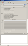
Maptemplate GUI
|
Example GUI Screenshot of maptemplate GUI before the center longitude was entered for the sinusoidal projection. |
Example 2
Lambert Conformal Map Template
Description
Group = Mapping
  ProjectionName     = LambertConformal
  CenterLongitude    = 0.0
  CenterLatitude     = 90.0
  StandardParallel1  = 45.0
  StandardParallel2  = 55.0
  TargetName         = Mars
  EquatorialRadius   = 3396190.0 <meters>
  PolarRadius        = 3376200.0 <meters>
  LatitudeType       = Planetocentric
  LongitudeDirection = PositiveEast
  LongitudeDomain    = 360
End_Group
The text shown above is the contents of the output file created when the
following command line is executed.
Command Line
History
| Elizabeth Ribelin | 2005-09-13 | Original Version |
| Elizabeth Miller | 2005-11-17 | Added .map extension to TO file and fixed bug with spaces in the projection name |
| Elizabeth Miller | 2006-05-18 | Deprecated CubeProjection and ProjectionManager to ProjectionFactory |
| Robert Sucharski | 2006-06-02 | Redid GUI, added code to calculate ground range and resolution using FROMLIST, and added Help buttons |
| Steven Lambright | 2008-04-23 | Added oblique cylindrical projection |
| Steven Lambright | 2009-02-05 | Fixed a problem that occurred when using "TARGOPT=USER", "RNGOPT=CALC" and not entering "EQRADIUS" or "POLRADIUS" |
| Steven Lambright | 2011-12-19 | Updated documentation as per Ella Lee's recommendations in preparation for the January 2012 release. |
| Kimberly Oyama | 2013-04-03 | Added support for Point Perspective Projection. Fixes #212. |
| Debbie A. Cook | 2013-04-16 | Changed to use TProjection instead of Projection. References #775 |
| Ella Mae Lee | 2013-11-25 | Added LambertAzimuthalEqualArea and Robinson projections. Updated the user documentation, fixes #845. |
| Ella Mae Lee | 2013-12-12 | Backward compatability issue due to parameter name change: TARGOPT options changed from SYSTEM to SELECT, IMAGE to NONE, and TARGDEF to FILE. The description was modified to describe the behavior when selected, fixes #845. |
| Jeannie Backer | 2016-04-22 | Added error message to alert to the user when the program fails to find TargetRadii. Added errors appTest. References #3892 |