 |
Isis Developer Reference
|
|
Isis Developer Reference
|
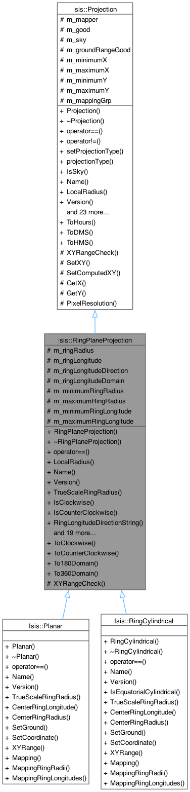
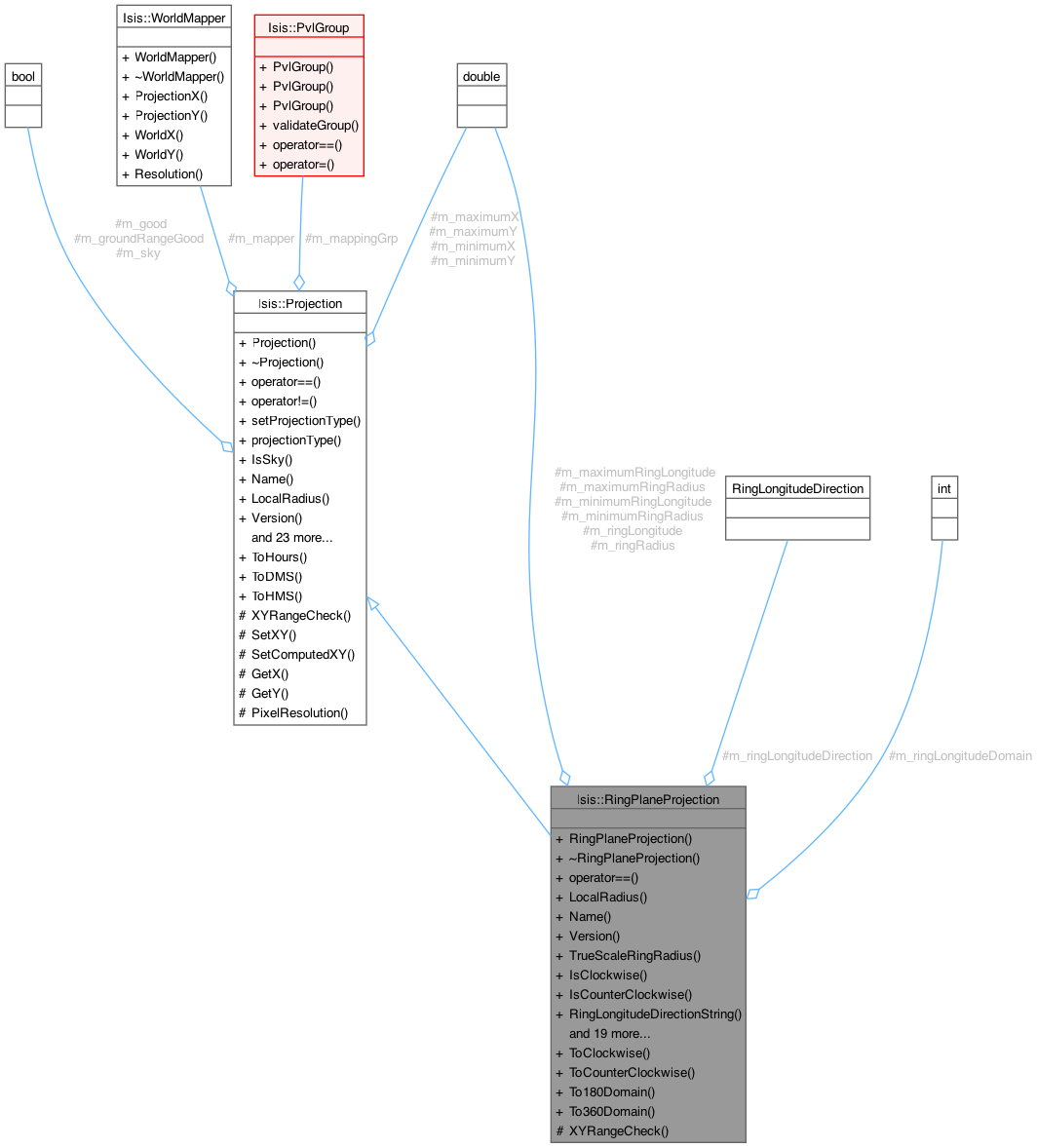
Base class for Map Projections of plane shapes. More...
#include <RingPlaneProjection.h>
Public Types | |
| enum | RingLongitudeDirection { Clockwise , CounterClockwise } |
| This enum defines the types of ring longitude directions supported in this class. More... | |
| enum | ProjectionType { Triaxial , RingPlane } |
| This enum defines the subclasses of Projection supported in Isis. More... | |
Public Member Functions | |
| RingPlaneProjection (Pvl &label) | |
| Constructs an empty RingPlaneProjection object. | |
| virtual | ~RingPlaneProjection () |
| Destroys the Projection object. | |
| virtual bool | operator== (const Projection &proj) |
| This method determines whether two map projection objects are equal by comparing the ring longitude direction, resolution, and projection name. | |
| double | LocalRadius () const |
| This returns a local radius. | |
| virtual QString | Name () const =0 |
| This method returns the name of the map projection. | |
| virtual QString | Version () const =0 |
| This method returns the Version of the map projection. | |
| virtual double | TrueScaleRingRadius () const |
| This method returns the radius of true scale. | |
| bool | IsClockwise () const |
| This indicates if the longitude direction type is positive west (as opposed to postive east). | |
| bool | IsCounterClockwise () const |
| This indicates if the longitude direction type is positive east (as opposed to postive west). | |
| std::string | RingLongitudeDirectionString () const |
| This method returns the ring longitude direction as a string. | |
| bool | Has180Domain () const |
| This indicates if the longitude domain is -180 to 180 (as opposed to 0 to 360). | |
| bool | Has360Domain () const |
| This indicates if the ring longitude domain is 0 to 360 (as opposed to -180 to 180). | |
| std::string | RingLongitudeDomainString () const |
| This method returns the ring longitude domain as a string. | |
| double | MinimumRingRadius () const |
| This returns the minimum radius of the area of interest. | |
| double | MaximumRingRadius () const |
| This returns the maximum radius of the area of interest. | |
| double | MinimumRingLongitude () const |
| This returns the minimum ring longitude of the area of interest. | |
| double | MaximumRingLongitude () const |
| This returns the maximum ring longitude of the area of interest. | |
| virtual bool | SetGround (const double ringRadius, const double ringLongitude) |
| This method is used to set the ring radius/longitude (assumed to be of the correct LatitudeType, LongitudeDirection, and LongitudeDomain. | |
| virtual bool | SetCoordinate (const double x, const double y) |
| This method is used to set the projection x/y. | |
| double | RingRadius () const |
| This returns a radius. | |
| double | RingLongitude () const |
| This returns a ring longitude with correct ring longitude direction and domain as specified in the label object. | |
| bool | SetUniversalGround (const double ringRadius, const double ringLongitude) |
| This method is used to set the ring radius/longitude which must be PositiveEast/Domain360 (ring longitude). | |
| double | UniversalRingRadius () |
| This returns a universal radius, which is just the radius in meters. | |
| double | UniversalRingLongitude () |
| This returns a universal ring longitude (clockwise in 0 to 360 domain). | |
| double | Scale () const |
| This method returns the scale for mapping world coordinates into projection coordinates. | |
| virtual bool | XYRange (double &minX, double &maxX, double &minY, double &maxY) |
| This method is used to determine the x/y range which completely covers the area of interest specified by the ring radius/longitude range. | |
| virtual PvlGroup | Mapping () |
| This method is used to find the XY range for oblique aspect projections (non-polar projections) by "walking" around each of the min/max ring rad/lon. | |
| virtual PvlGroup | MappingRingRadii () |
| This function returns the ring radius keywords that this projection uses. | |
| virtual PvlGroup | MappingRingLongitudes () |
| This function returns the ring longitude keywords that this projection uses. | |
| bool | operator!= (const Projection &proj) |
| This method determines whether two map projection objects are not equal. | |
| void | setProjectionType (const ProjectionType ptype) |
| Sets the projection subclass type. | |
| ProjectionType | projectionType () const |
| Returns an enum value for the projection type. | |
| bool | IsSky () const |
| Returns true if projection is sky and false if it is land. | |
| virtual bool | IsEquatorialCylindrical () |
| This method returns true if the projection is equatorial cylindrical. | |
| virtual bool | HasGroundRange () const |
| This indicates if the longitude direction type is positive west (as opposed to postive east). | |
| double | Rotation () const |
| Returns the value of the Rotation keyword from the mapping group. | |
| void | SetWorldMapper (WorldMapper *mapper) |
| If desired the programmer can use this method to set a world mapper to be used in the SetWorld, WorldX, and WorldY methods. | |
| bool | IsGood () const |
| This indicates if the last invocation of SetGround, SetCoordinate, SetUniversalGround, or SetWorld was with successful or not. | |
| double | XCoord () const |
| This returns the projection X provided SetGround, SetCoordinate, SetUniversalGround, or SetWorld returned with success. | |
| double | YCoord () const |
| This returns the projection Y provided SetGround, SetCoordinate, SetUniversalGround, or SetWorld returned with success. | |
| virtual bool | SetUnboundUniversalGround (const double coord1, const double coord2) |
| This method is used to set the lat/lon or radius/azimuth (i.e. | |
| virtual bool | SetWorld (const double x, const double y) |
| This method is used to set a world coordinate. | |
| virtual double | WorldX () const |
| This returns the world X coordinate provided SetGround, SetCoordinate, SetUniversalGround, or SetWorld returned with success. | |
| virtual double | WorldY () const |
| This returns the world Y coordinate provided SetGround, SetCoordinate, SetUniversalGround, or SetWorld returned with success. | |
| double | ToWorldX (const double projectionX) const |
| This method converts a projection x value to a world x value. | |
| double | ToWorldY (const double projectionY) const |
| This method converts a projection y value to a world y value. | |
| double | ToProjectionX (const double worldX) const |
| This method converts a world x value to a projection x value. | |
| double | ToProjectionY (const double worldY) const |
| This method converts a world y value to a projection y value. | |
| double | Resolution () const |
| This method returns the resolution for mapping world coordinates into projection coordinates. | |
| void | SetUpperLeftCorner (const Displacement &x, const Displacement &y) |
| This method searches for extreme (min/max/discontinuity) coordinate values along the constBorder line between minBorder and maxBorder (that is, across latitudes/longitudes). | |
Static Public Member Functions | |
| static double | ToClockwise (const double ringLongitude, const int domain) |
| This method converts an ring longitude into the clockwise direction. | |
| static double | ToCounterClockwise (const double ringLongitude, const int domain) |
| This method converts an ring longitude into the counterclockwise direction. | |
| static double | To180Domain (const double lon) |
| This method converts a ring longitude into the -180 to 180 domain. | |
| static double | To360Domain (const double lon) |
| This method converts an ring longitude into the 0 to 360 domain. | |
| static double | ToHours (double angle) |
| Converts the given angle (in degrees) to hours by using the ratio 15 degrees per hour. | |
| static QString | ToDMS (double angle) |
| Converts the given angle (in degrees) to degrees, minutes, seconds. | |
| static QString | ToHMS (double angle) |
| Converts the given angle (in degrees) to hours, minutes, seconds. | |
Protected Member Functions | |
| void | XYRangeCheck (const double ringRadius, const double ringLongitude) |
| This convience function is established to assist in the development of the XYRange virtual method. | |
| void | SetXY (double x, double y) |
| This protected method is a helper for derived classes. | |
| void | SetComputedXY (double x, double y) |
| This protected method is a helper for derived classes. | |
| double | GetX () const |
| Calculates the unrotated form of current x value. | |
| double | GetY () const |
| Calculates the unrotated form of the current y value. | |
| double | PixelResolution () const |
| Returns the pixel resolution value from the PVL mapping group in meters/pixel. | |
Protected Attributes | |
| double | m_ringRadius |
| This contain a ring radius value in m. | |
| double | m_ringLongitude |
| This contain a ring longitude value. | |
| RingLongitudeDirection | m_ringLongitudeDirection |
| An enumerated type indicating the LongitudeDirection read from the labels. | |
| int | m_ringLongitudeDomain |
| This integer is either 180 or 360 and is read from the labels. | |
| double | m_minimumRingRadius |
| Contains the minimum ring radius for the entire ground range. | |
| double | m_maximumRingRadius |
| Contains the maximum ring radius for the entire ground range. | |
| double | m_minimumRingLongitude |
| Contains the minimum longitude for the entire ground range. | |
| double | m_maximumRingLongitude |
| Contains the maximum longitude for the entire ground range. | |
| WorldMapper * | m_mapper |
| This points to a mapper passed into the SetWorldMapper method. | |
| bool | m_good |
| Indicates if the contents of m_x, m_y, m_latitude, and m_longitude are valid. | |
| bool | m_sky |
| Indicates whether projection is sky or land. | |
| bool | m_groundRangeGood |
| Indicates if the ground range (min/max lat/lons) were read from the labels. | |
| double | m_minimumX |
| The data elements m_minimumX, m_minimumY, m_maximumX, and m_maximumY are convience data elements when you write the XYRange virtual function. | |
| double | m_maximumX |
| See minimumX description. | |
| double | m_minimumY |
| See minimumX description. | |
| double | m_maximumY |
| See minimumX description. | |
| PvlGroup | m_mappingGrp |
| Mapping group that created this projection. | |
Base class for Map Projections of plane shapes.
This is a virtual base class for map projections of plane shape targets. It must be used to create specific map projection classes such as PlaneCylindrical, PlanePolar, etc. The foundation of this class is the ability to convert plane ground coordinates (ring radius and ring longitude) into projection coordinates (x and y) and vice versa. Options exist to allow conversion to and from programmer specified world coordinates. The world coordinates can be cube pixels, paper units in millimeters, or any other unit the program may need. Generally, you should never directly instantiate this class.
Here is an example of how to use RingPlaneProjection
If you would like to see Projection being used in implementation, see mappos.cpp
|
inherited |
This enum defines the subclasses of Projection supported in Isis.
| Enumerator | |
|---|---|
| Triaxial | These projections are used to map triaxial and irregular-shaped bodies. |
| RingPlane | These projections are used to map ring planes. |
| Isis::RingPlaneProjection::RingPlaneProjection | ( | Pvl & | label | ) |
Constructs an empty RingPlaneProjection object.
| label | A PVL object containing map projection labels. These labels are fully described in the Isis Map Projection Users Guide. A brief example follows: Group = Mapping
RingLongitudeDirection = PositiveEast
RingLongitudeDomain = 360
MinimumRingRadius = 10.8920539924144
MaximumRingRadius = 34.7603960060206
MinimumRingLongitude = 219.72432466275
MaximumRingLongitude = 236.186050244411
PixelResolution = 1387.31209461362
ProjectionName = Planar
CenterRingLongitude = 220.0
EndGroup
End
double PixelResolution() const Returns the pixel resolution value from the PVL mapping group in meters/pixel. Definition Projection.cpp:840 double MaximumRingLongitude() const This returns the maximum ring longitude of the area of interest. Definition RingPlaneProjection.cpp:438 virtual PvlGroup Mapping() This method is used to find the XY range for oblique aspect projections (non-polar projections) by "w... Definition RingPlaneProjection.cpp:1253 double MaximumRingRadius() const This returns the maximum radius of the area of interest. Definition RingPlaneProjection.cpp:416 RingLongitudeDirection This enum defines the types of ring longitude directions supported in this class. Definition RingPlaneProjection.h:178 double MinimumRingLongitude() const This returns the minimum ring longitude of the area of interest. Definition RingPlaneProjection.cpp:427 double MinimumRingRadius() const This returns the minimum radius of the area of interest. Definition RingPlaneProjection.cpp:405 |
| IException::Unknown | - "Projection failed. Invalid value for keyword [RingLongitudeDirection] must be [Clockwise or CounterClockwise]" |
| IException::Unknown | - "Projection failed. Invalid value for keyword [RingLongitudeDomain] must be [180 or 360]" |
| IException::Unknown | - "Projection failed. [MinimumRingRadius] is not valid" |
| IException::Unknown | - "Projection failed. [MaximumRingRadius] is not valid" |
| IException::Unknown | - "Projection failed. [MinimumRingRadius,MaximumRingRadius] are not properly ordered" |
| IException::Unknown | - "Projection failed. [MinimumRingLongitude,MaximumRingLongitude] are not properly ordered" |
| IException::Unknown | - "Projection failed. Invalid label group [Mapping]" |
References _FILEINFO_, Clockwise, CounterClockwise, Isis::PvlContainer::hasKeyword(), Isis::Projection::m_groundRangeGood, Isis::Projection::m_mappingGrp, m_maximumRingLongitude, m_maximumRingRadius, m_minimumRingLongitude, m_minimumRingRadius, m_ringLongitude, m_ringLongitudeDirection, m_ringLongitudeDomain, m_ringRadius, Isis::Null, Isis::Projection::RingPlane, Isis::Projection::setProjectionType(), and Isis::IException::Unknown.
|
virtual |
Destroys the Projection object.
|
protectedinherited |
Calculates the unrotated form of current x value.
References Isis::PI.
Referenced by Isis::Equirectangular::SetCoordinate(), Isis::LambertConformal::SetCoordinate(), Isis::Mercator::SetCoordinate(), Isis::ObliqueCylindrical::SetCoordinate(), Isis::Orthographic::SetCoordinate(), Isis::PointPerspective::SetCoordinate(), Isis::PolarStereographic::SetCoordinate(), Isis::RingCylindrical::SetCoordinate(), Isis::SimpleCylindrical::SetCoordinate(), Isis::Sinusoidal::SetCoordinate(), and Isis::TransverseMercator::SetCoordinate().
|
protectedinherited |
Calculates the unrotated form of the current y value.
References Isis::PI.
Referenced by Isis::Equirectangular::SetCoordinate(), Isis::LambertConformal::SetCoordinate(), Isis::Mercator::SetCoordinate(), Isis::ObliqueCylindrical::SetCoordinate(), Isis::Orthographic::SetCoordinate(), Isis::PointPerspective::SetCoordinate(), Isis::PolarStereographic::SetCoordinate(), Isis::RingCylindrical::SetCoordinate(), Isis::SimpleCylindrical::SetCoordinate(), Isis::Sinusoidal::SetCoordinate(), and Isis::TransverseMercator::SetCoordinate().
| bool Isis::RingPlaneProjection::Has180Domain | ( | ) | const |
This indicates if the longitude domain is -180 to 180 (as opposed to 0 to 360).
The ring longitude domain was obtained from the label during object construction.
References m_ringLongitudeDomain.
Referenced by operator==().
| bool Isis::RingPlaneProjection::Has360Domain | ( | ) | const |
This indicates if the ring longitude domain is 0 to 360 (as opposed to -180 to 180).
The ring longitude domain was obtained from the label during object construction.
References m_ringLongitudeDomain.
|
virtualinherited |
This indicates if the longitude direction type is positive west (as opposed to postive east).
The longitude type was obtained from the label during object construction.
| lon | Longitude to convert into the -180 to 180 domain. |
| IException::Unknown | - "The given longitude is invalid." |
| lon | Longitude to convert into the 0 to 360 domain. |
References Isis::Projection::m_groundRangeGood.
Referenced by Mapping(), Isis::TProjection::MappingLatitudes(), Isis::TProjection::MappingLongitudes(), Isis::Planar::MappingRingLongitudes(), Isis::RingCylindrical::MappingRingLongitudes(), MappingRingLongitudes(), Isis::Planar::MappingRingRadii(), Isis::RingCylindrical::MappingRingRadii(), MappingRingRadii(), and Isis::TProjection::xyRangeOblique().
| bool Isis::RingPlaneProjection::IsClockwise | ( | ) | const |
This indicates if the longitude direction type is positive west (as opposed to postive east).
The longitude type was obtained from the label during object construction.
References Clockwise, and m_ringLongitudeDirection.
Referenced by operator==().
| bool Isis::RingPlaneProjection::IsCounterClockwise | ( | ) | const |
This indicates if the longitude direction type is positive east (as opposed to postive west).
The longitude type was obtained from the label during object construction.
References CounterClockwise, and m_ringLongitudeDirection.
|
virtualinherited |
This method returns true if the projection is equatorial cylindrical.
In other words, if the projection is cylindrical and an image projected at 0 is the same as an image projected at 360.
Reimplemented in Isis::Equirectangular, Isis::Mercator, Isis::RingCylindrical, Isis::SimpleCylindrical, and Isis::TProjection.
Referenced by Isis::ShapeModelFactory::create().
|
inherited |
This indicates if the last invocation of SetGround, SetCoordinate, SetUniversalGround, or SetWorld was with successful or not.
If there was success then the Latitude, Longitude, XCoord, YCoord, UniversalLatitude, UniversalLongitude, WorldX, and WorldY methods can be utilized.
References Isis::Projection::m_good.
Referenced by Isis::TProjection::XYRangeCheck(), and XYRangeCheck().
|
inherited |
Returns true if projection is sky and false if it is land.
References Isis::Projection::m_sky.
Referenced by Isis::Camera::SetImage(), Isis::Camera::SetImage(), and Isis::Camera::SetRightAscensionDeclination().
|
virtual |
This returns a local radius.
The method can only be used if SetGround, SetCoordinate, SetUniversalGround, or SetWorld return with success. Success can also be checked using the IsGood method.
Implements Isis::Projection.
References m_ringRadius.
|
virtual |
This method is used to find the XY range for oblique aspect projections (non-polar projections) by "walking" around each of the min/max ring rad/lon.
| minX | Minimum x projection coordinate which covers the ring radius/longitude range specified in the labels. |
| maxX | Maximum x projection coordinate which covers the ring radius/longitude range specified in the labels. |
| minY | Minimum y projection coordinate which covers the ring radius/longitude range specified in the labels. |
| maxY | Maximum y projection coordinate which covers the ring radius/longitude range specified in the labels. |
Discontinuities are stored in m_specialLatCases and m_specialLonCases so they may be checked again later, which creates significantly more accuracy in some cases.
| minBorder | Minimum latitude or longitude to search between. |
| maxBorder | Maximum latitude or longitude to search between. |
| extremeVal | The resulting global coordinate value (min or max value for x or y, depending on findMin and searchX) on the constBorder. |
| constBorder | The latitude or longitude that remains constant. The method will step along this border. |
| searchX | Indicates whether the method is searching for a min or max x-coordinate. If false the method searches for min or max y-coordinate. |
| searchLongitude | Indicates whether the method will search along a longitude. If true, constBorder is longitude and all other borders are latitudes. If false, the method searches a latitude (constBorder is a lat, other borders lons). |
| findMin | Indicates whether the method is looking for a minimum coordinate value. If false, the method is looking for a maximum value. |
This method looks for these extrema along the constBorder between minBorder and maxBorder by stepping along constBorder (10 times) from the minBorder and maxBorder. Then, the range of this extreme value is recorded in minBorder and maxBorder and the coordinate values corresponding to these new borders are stored in minBorderX, minBorderY, maxBorderX and maxBorderY.
This function should be used by calling it repeatedly until minBorderX and minBorderY do not equal maxBorderX and maxBorderY, respectively. Discontinuities will cause the minBorderX, minBorderY, maxBorderX and maxBorderY to never converge. If minBorderX never comes close to maxBorderX or minBorderY never comes close to maxBorderY, then between minBorder and maxBorder is the value of the most extreme value. In this case, either the smaller or larger of the x or y values found will be correct, depending on the values of findMin and searchX.
| minBorder | Minimum latitude or longitude to search between. This value gets updated to a more precise range. |
| maxBorder | Maximum latitude or longitude to search between. This value gets updated to a more precise range. |
| minBorderX | The x-value corresponding to the lower resultant minBorder and the constBorder, which is more accurate when nearly equal to maxBorderX. |
| minBorderY | The y-value corresponding to the lower resultant minBorder and the constBorder, which is more accurate when nearly equal to maxBorderY. |
| maxBorderX | The x-value corresponding to the higher resultant maxBorder and the constBorder, which is more accurate when nearly equal to minBorderX. |
| maxBorderY | The y-value corresponding to the higher resultant maxBorder and the constBorder, which is more accurate when nearly equal to minBorderY. |
| constBorder | The latitude or longitude that remains constant. The method will step along this border. |
| searchX | Indicates whether the method is searching for a min or max x-coordinate. If false the method searches for min or max y-coordinate. |
| searchLongitude | Indicates whether the method will search along a longitude. If true, constBorder is longitude and all other borders are latitudes. If false, the method searches a latitude (constBorder is a lat, other borders lons). |
| findMin | Indicates whether the method is looking for a minimum coordinate value. If false, the method is looking for a maximum value. |
This method is used by doSearch and findExtreme in order to set the ground correctly each time.
| variableBorder | The latitude or longitude that is variable in the search methods. |
| constBorder | The latitude or longitude that is constant in the search methods. |
| variableIsLat | Indicates whether variableBorder is the latittude value and constBorder is the longitude value. If false, variableBorder is the longitude value and constBorder is the latitude value. |
Implements Isis::Projection.
Reimplemented in Isis::Planar, and Isis::RingCylindrical.
References Isis::Projection::HasGroundRange(), Isis::PvlContainer::hasKeyword(), and Isis::Projection::m_mappingGrp.
Referenced by Isis::Planar::Mapping(), and Isis::RingCylindrical::Mapping().
|
virtual |
This function returns the ring longitude keywords that this projection uses.
Reimplemented in Isis::Planar, and Isis::RingCylindrical.
References Isis::Projection::HasGroundRange(), and Isis::Projection::m_mappingGrp.
Referenced by Isis::Planar::MappingRingLongitudes(), and Isis::RingCylindrical::MappingRingLongitudes().
|
virtual |
This function returns the ring radius keywords that this projection uses.
Reimplemented in Isis::Planar, and Isis::RingCylindrical.
References Isis::Projection::HasGroundRange(), and Isis::Projection::m_mappingGrp.
Referenced by Isis::Planar::MappingRingRadii(), and Isis::RingCylindrical::MappingRingRadii().
| double Isis::RingPlaneProjection::MaximumRingLongitude | ( | ) | const |
This returns the maximum ring longitude of the area of interest.
The value was obtained from the labels during object construction. This method can only be used if HasGroundRange returns a true.
References m_maximumRingLongitude.
| double Isis::RingPlaneProjection::MaximumRingRadius | ( | ) | const |
This returns the maximum radius of the area of interest.
The value was obtained from the labels during object construction. This method can only be used if HasGroundRange returns a true.
References m_maximumRingRadius.
| double Isis::RingPlaneProjection::MinimumRingLongitude | ( | ) | const |
This returns the minimum ring longitude of the area of interest.
The value was obtained from the labels during object construction. This method can only be used if HasGroundRange returns a true.
References m_minimumRingLongitude.
| double Isis::RingPlaneProjection::MinimumRingRadius | ( | ) | const |
This returns the minimum radius of the area of interest.
The value was obtained from the labels during object construction. This method can only be used if HasGroundRange returns a true.
References m_minimumRingRadius.
|
pure virtual |
This method returns the name of the map projection.
It is a pure virtual method (requires all subclasses to override).
Implements Isis::Projection.
Implemented in Isis::Planar, and Isis::RingCylindrical.
|
inherited |
This method determines whether two map projection objects are not equal.
True is returned if they have at least some differences in the radii, latitude type, longitude direction, resolution, or projection name.
| proj | A reference to a Projection object to which this Projection will be compared. |
|
virtual |
This method determines whether two map projection objects are equal by comparing the ring longitude direction, resolution, and projection name.
| proj | A reference to a Projection object to which this Projection will be compared. |
Reimplemented from Isis::Projection.
Reimplemented in Isis::Planar, and Isis::RingCylindrical.
References Has180Domain(), and IsClockwise().
|
protectedinherited |
Returns the pixel resolution value from the PVL mapping group in meters/pixel.
Referenced by Isis::Planar::XYRange(), and Isis::RingCylindrical::XYRange().
|
inherited |
Returns an enum value for the projection type.
Referenced by Isis::MosaicFindTool::getUserGroundPoint(), Isis::GridGraphicsItem::GridGraphicsItem(), Isis::UniversalGroundMap::GroundRange(), Isis::MosaicControlNetTool::mouseButtonRelease(), Isis::MosaicFindTool::mouseButtonRelease(), Isis::Projection::SetUnboundUniversalGround(), Isis::Projection::SetUniversalGround(), Isis::UniversalGroundMap::UniversalLatitude(), Isis::UniversalGroundMap::UniversalLongitude(), and Isis::MosaicAreaTool::userChangedBox().
|
inherited |
This method returns the resolution for mapping world coordinates into projection coordinates.
For example, if the world coordinate system is an image then this routine returns the number of meters per pixel. Likewise, if the world coordinate system is a piece of paper, it might return the number of meters per inch of paper. If the SetWorldMapper method is not invoked then this method returns 1.0
References Isis::Projection::m_mapper, and Isis::WorldMapper::Resolution().
Referenced by Isis::Projection::operator==(), and Isis::UniversalGroundMap::Resolution().
| double Isis::RingPlaneProjection::RingLongitude | ( | ) | const |
This returns a ring longitude with correct ring longitude direction and domain as specified in the label object.
The method can only be used if SetGround, SetCoordinate, SetUniversalGround, or SetWorld return with success. Success can also be checked using the IsGood method.
References m_ringLongitude.
| string Isis::RingPlaneProjection::RingLongitudeDirectionString | ( | ) | const |
This method returns the ring longitude direction as a string.
It will return either Clockwise or CounterClockwise.
References Clockwise, and m_ringLongitudeDirection.
| string Isis::RingPlaneProjection::RingLongitudeDomainString | ( | ) | const |
This method returns the ring longitude domain as a string.
It will return either 180 or 360.
References m_ringLongitudeDomain.
| double Isis::RingPlaneProjection::RingRadius | ( | ) | const |
This returns a radius.
The method can only be used if SetGround, SetCoordinate, SetUniversalGround, or SetWorld return with success. Success can also be checked using the IsGood method.
References m_ringRadius.
|
inherited |
Returns the value of the Rotation keyword from the mapping group.
|
virtual |
This method returns the scale for mapping world coordinates into projection coordinates.
For example, if the world coordinate system is an image then this routine returns the number of pixels per degree. Likewise, if the world coordinate system is a piece of paper, it might return the number of inches of paper per degree. If the SetWorldMapper method is not invoked then this method returns 1.0
Implements Isis::Projection.
References Isis::DEG2RAD, Isis::Projection::m_mapper, Isis::WorldMapper::Resolution(), and TrueScaleRingRadius().
|
protectedinherited |
This protected method is a helper for derived classes.
It takes unrotated x and y values, rotates them using the rotation angle data member, and stores the results in the current x and y data members.
| x | The unrotated x coordinate. |
| y | The unrotated y coordinate. |
References Isis::Projection::m_good, Isis::Null, and Isis::PI.
Referenced by Isis::Equirectangular::SetGround(), Isis::LambertConformal::SetGround(), Isis::LunarAzimuthalEqualArea::SetGround(), Isis::Mercator::SetGround(), Isis::ObliqueCylindrical::SetGround(), Isis::Orthographic::SetGround(), Isis::PointPerspective::SetGround(), Isis::PolarStereographic::SetGround(), Isis::Robinson::SetGround(), Isis::SimpleCylindrical::SetGround(), Isis::Sinusoidal::SetGround(), Isis::TProjection::SetGround(), Isis::TransverseMercator::SetGround(), Isis::Planar::SetGround(), Isis::RingCylindrical::SetGround(), and SetGround().
|
virtual |
This method is used to set the projection x/y.
The Set forces an attempted calculation of the corresponding ring radius/longitude position. This may or may not be successful and a status is returned as such. Usually this method is overridden in a dervied class, for example, Sinusoidal. If not the default method simply copies x/y to ring rad/lon to x/y which is no projection.
| x | X coordinate of the projection in units that are the same as the radii in the label |
| y | Y coordinate of the projection in units that are the same as the ring longitude in the label |
Implements Isis::Projection.
Reimplemented in Isis::Planar, and Isis::RingCylindrical.
References Isis::Projection::m_good, m_ringLongitude, m_ringRadius, Isis::Null, Isis::Projection::SetXY(), Isis::Projection::XCoord(), and Isis::Projection::YCoord().
|
virtual |
This method is used to set the ring radius/longitude (assumed to be of the correct LatitudeType, LongitudeDirection, and LongitudeDomain.
The Set forces an attempted calculation of the projection X/Y values. This may or may not be successful and a status is returned as such. Usually this method is overridden in a dervied class, for example, Sinusoidal. If not the default method simply copies ring rad/lon to x/y which is no projection.
| ringRadius | The ring radius value to project |
| ringLongitude | The ring longitude value to project |
Implements Isis::Projection.
Reimplemented in Isis::Planar, and Isis::RingCylindrical.
References Isis::Projection::m_good, m_ringLongitude, m_ringRadius, Isis::Null, and Isis::Projection::SetComputedXY().
Referenced by SetUniversalGround(), and XYRangeCheck().
|
inherited |
Sets the projection subclass type.
| ptype | The projection subclass type |
Referenced by RingPlaneProjection(), and Isis::TProjection::TProjection().
|
virtualinherited |
This method is used to set the lat/lon or radius/azimuth (i.e.
ring longitude) coordinate, depending on the projection type. The Set forces an attempted calculation of the projection X/Y values. This may or may not be successful and a status is returned as such. This method will not adjust the longitude coordinate based on the longitude domain.
| coord1 | Latitude (planetocentric) or ring radius to project |
| coord2 | Longitude or ring longitude to project. The value passed in should be PositiveEast, Domain360. |
Reimplemented in Isis::TProjection.
References Isis::Projection::m_good, Isis::Null, Isis::Projection::projectionType(), Isis::TProjection::SetUnboundUniversalGround(), SetUniversalGround(), and Isis::Projection::Triaxial.
Referenced by Isis::UniversalGroundMap::SetUnboundGround().
|
virtual |
This method is used to set the ring radius/longitude which must be PositiveEast/Domain360 (ring longitude).
The Set forces an attempted calculation of the projection X/Y values. This may or may not be successful and a status is returned as such.
| ringRadius | The ring radius value to project |
| ringLongitude | PositiveEast, Domain360 ring longitude value to project |
Reimplemented from Isis::Projection.
References Clockwise, Isis::Projection::m_good, m_ringLongitude, m_ringLongitudeDirection, m_ringLongitudeDomain, m_ringRadius, Isis::Null, SetGround(), To180Domain(), and To360Domain().
Referenced by Isis::Projection::SetUnboundUniversalGround(), and Isis::Projection::SetUniversalGround().
|
inherited |
This method searches for extreme (min/max/discontinuity) coordinate values along the constBorder line between minBorder and maxBorder (that is, across latitudes/longitudes).
This method locates the extrema by utilizing the findExtreme() method until the coordinate values converge. Then, extremeVal parameter is updated with this value before returning.
Discontinuities are stored in m_specialLatCases and m_specialLonCases so they may be checked again later, which creates significantly more accuracy in some cases.
| minBorder | Minimum latitude or longitude to search between. |
| maxBorder | Maximum latitude or longitude to search between. |
| extremeVal | The resulting global coordinate value (min or max value for x or y, depending on findMin and searchX) on the constBorder. |
| constBorder | The latitude or longitude that remains constant. The method will step along this border. |
| searchX | Indicates whether the method is searching for a min or max x-coordinate. If false the method searches for min or max y-coordinate. |
| searchLongitude | Indicates whether the method will search along a longitude. If true, constBorder is longitude and all other borders are latitudes. If false, the method searches a latitude (constBorder is a lat, other borders lons). |
| findMin | Indicates whether the method is looking for a minimum coordinate value. If false, the method is looking for a maximum value. |
This method looks for these extrema along the constBorder between minBorder and maxBorder by stepping along constBorder (10 times) from the minBorder and maxBorder. Then, the range of this extreme value is recorded in minBorder and maxBorder and the coordinate values corresponding to these new borders are stored in minBorderX, minBorderY, maxBorderX and maxBorderY.
This function should be used by calling it repeatedly until minBorderX and minBorderY do not equal maxBorderX and maxBorderY, respectively. Discontinuities will cause the minBorderX, minBorderY, maxBorderX and maxBorderY to never converge. If minBorderX never comes close to maxBorderX or minBorderY never comes close to maxBorderY, then between minBorder and maxBorder is the value of the most extreme value. In this case, either the smaller or larger of the x or y values found will be correct, depending on the values of findMin and searchX.
| minBorder | Minimum latitude or longitude to search between. This value gets updated to a more precise range. |
| maxBorder | Maximum latitude or longitude to search between. This value gets updated to a more precise range. |
| minBorderX | The x-value corresponding to the lower resultant minBorder and the constBorder, which is more accurate when nearly equal to maxBorderX. |
| minBorderY | The y-value corresponding to the lower resultant minBorder and the constBorder, which is more accurate when nearly equal to maxBorderY. |
| maxBorderX | The x-value corresponding to the higher resultant maxBorder and the constBorder, which is more accurate when nearly equal to minBorderX. |
| maxBorderY | The y-value corresponding to the higher resultant maxBorder and the constBorder, which is more accurate when nearly equal to minBorderY. |
| constBorder | The latitude or longitude that remains constant. The method will step along this border. |
| searchX | Indicates whether the method is searching for a min or max x-coordinate. If false the method searches for min or max y-coordinate. |
| searchLongitude | Indicates whether the method will search along a longitude. If true, constBorder is longitude and all other borders are latitudes. If false, the method searches a latitude (constBorder is a lat, other borders lons). |
| findMin | Indicates whether the method is looking for a minimum coordinate value. If false, the method is looking for a maximum value. |
This method is used by doSearch and findExtreme in order to set the ground correctly each time.
| variableBorder | The latitude or longitude that is variable in the search methods. |
| constBorder | The latitude or longitude that is constant in the search methods. |
| variableIsLat | Indicates whether variableBorder is the latittude value and constBorder is the longitude value. If false, variableBorder is the longitude value and constBorder is the latitude value. |
| x | the upper left corner x value |
| y | the upper left corner y value |
References Isis::PvlContainer::addKeyword(), Isis::Projection::m_mappingGrp, Isis::Displacement::meters(), Isis::PvlContainer::Replace, and Isis::toString().
|
virtualinherited |
This method is used to set a world coordinate.
A world coordinate is a different coordinate type that has a one-to-one mapping to the projection coordinate system. For example, mapping pixel samples and lines to projection x's and y's. The Set forces an attempted calculation of the corresponding latitude/longitude position. This may or may not be successful and a status is returned as such. Note that is only applies if the Projection object was given an WorldMapper object during construction. If an WorldMapper was not supplied then SetWorld operates exactly the same as SetCoordinate (impling that world coordinate and projection coordinate are identical).
| worldX | World X coordinate in units that are specified by the WorldMapper object (e.g., pixels, millimeters, etc) |
| worldY | World Y coordinate in units that are specified by the WorldMapper object (e.g., pixels, millimeters, etc) |
References Isis::Projection::m_mapper, Isis::WorldMapper::ProjectionX(), Isis::WorldMapper::ProjectionY(), and Isis::Projection::SetCoordinate().
Referenced by Isis::ProcessExport::CreateWorldFile(), Isis::UniversalGroundMap::SetImage(), Isis::SubArea::UpdateLabel(), and Isis::PolygonTools::XYToLatLon().
|
inherited |
If desired the programmer can use this method to set a world mapper to be used in the SetWorld, WorldX, and WorldY methods.
Mappers typically transform a projection coordinate (x/y) into the desired working coordinate system, for example, cube pixels or inches on a piece of paper. They transform in both directions (world to projection and projection to world). This allows for conversions from line/sample to latitude/longitude and vice versa. This projection will take ownership of the WorldMapper pointer.
| mapper | Pointer to the mapper |
References Isis::Projection::m_mapper.
|
protectedinherited |
This protected method is a helper for derived classes.
It takes a rotated x,y and stores them in the current x and y data members.
| x | The rotated x coordinate. |
| y | The rotated y coordinate. |
References Isis::Projection::m_good, and Isis::Null.
Referenced by Isis::Equirectangular::SetCoordinate(), Isis::LambertConformal::SetCoordinate(), Isis::LunarAzimuthalEqualArea::SetCoordinate(), Isis::Mercator::SetCoordinate(), Isis::ObliqueCylindrical::SetCoordinate(), Isis::Orthographic::SetCoordinate(), Isis::Planar::SetCoordinate(), Isis::PointPerspective::SetCoordinate(), Isis::PolarStereographic::SetCoordinate(), Isis::RingCylindrical::SetCoordinate(), SetCoordinate(), Isis::Robinson::SetCoordinate(), Isis::SimpleCylindrical::SetCoordinate(), Isis::Sinusoidal::SetCoordinate(), Isis::TProjection::SetCoordinate(), and Isis::TransverseMercator::SetCoordinate().
|
static |
This method converts a ring longitude into the -180 to 180 domain.
It will leave the ring longitude unchanged if it is already in the domain.
| ringLongitude | A ring longitude to convert into the -180 to 180 domain. |
| IException::Unknown | - "The given longitude is invalid." |
References _FILEINFO_, Isis::Angle::Degrees, Isis::Angle::degrees(), Isis::Longitude::force180Domain(), Isis::Null, and Isis::IException::Unknown.
Referenced by Isis::Planar::SetCoordinate(), SetUniversalGround(), ToClockwise(), and ToCounterClockwise().
|
static |
This method converts an ring longitude into the 0 to 360 domain.
It will leave the ring longitude unchanged if it is already in the domain.
| ringLongitude | The ring longitude to convert into the 0 to 360 domain. |
References _FILEINFO_, Isis::Angle::Degrees, Isis::Angle::degrees(), Isis::Longitude::force360Domain(), Isis::Null, and Isis::IException::Unknown.
Referenced by Isis::Planar::SetCoordinate(), SetUniversalGround(), ToClockwise(), ToCounterClockwise(), and UniversalRingLongitude().
|
static |
This method converts an ring longitude into the clockwise direction.
| ringLongitude | The ring longitude to convert into the clockwise direction. |
| domain | Must be an integer value of 180 (for -180 to 180) or 360 (for 0 to 360). |
| IException::Unknown | - "The given ring longitude is invalid." |
| IException::Unknown | - "Unable to convert ring longitude. Domain is not 180 or 360." |
References _FILEINFO_, Isis::Null, To180Domain(), To360Domain(), Isis::toString(), and Isis::IException::Unknown.
|
static |
This method converts an ring longitude into the counterclockwise direction.
| ringLongitude | The ring Longitude to convert into the counterclockwise direction. |
| domain | Must be an integer value of 180 (for -180 to 180) or 360 (for 0 to 360). |
| IException::Unknown | - "The given ring longitude is invalid." |
| IException::Unknown | - "Unable to convert ring longitude. Domain is not 180 or 360." |
References _FILEINFO_, Isis::Null, To180Domain(), To360Domain(), and Isis::IException::Unknown.
|
staticinherited |
Converts the given angle (in degrees) to degrees, minutes, seconds.
Outputs in the form xxx yym zz.zzzs, for example, 206.291 degrees is 206 17m 27.6s
| angle | Angle in degrees to be converted to degrees, minutes, seconds |
|
staticinherited |
Converts the given angle (in degrees) to hours, minutes, seconds.
Outputs in the form xxh yym zz.zzzs For example, 206.291 will be 13h 45m 09.84s
| angle | Angle in degrees to be converted to hours, minutes, seconds |
References Isis::Projection::ToHours().
|
staticinherited |
Converts the given angle (in degrees) to hours by using the ratio 15 degrees per hour.
| angle | Angle in degrees to be converted to hours |
Referenced by Isis::Projection::ToHMS().
|
inherited |
This method converts a world x value to a projection x value.
For example, if the world coordinate system is an image then this method converts a sample position to a projection x value. Note that if SetWorldMapper is not used then this routine simply returns the value of the argument. That is, no mapping occurs.
| worldX | World x coordinate |
| IException::Unknown | - "The given x-value is invalid." |
References _FILEINFO_, Isis::Projection::m_mapper, Isis::Null, Isis::WorldMapper::ProjectionX(), and Isis::IException::Unknown.
|
inherited |
This method converts a world y value to a projection y value.
For example, if the world coordinate system is an image then this method converts a line position to a projection y value. Note that if SetWorldMapper is not used then this routine simply returns the value of the argument. That is, no mapping occurs.
| worldY | World y coordinate |
| IException::Unknown | - "The given y-value is invalid." |
References _FILEINFO_, Isis::Projection::m_mapper, Isis::Null, Isis::WorldMapper::ProjectionY(), and Isis::IException::Unknown.
|
inherited |
This method converts a projection x value to a world x value.
For example, if the world coordinate system is an image then this method converts a projection x to a sample position. Note that if SetWorldMapper is not used then this routine simply returns the value of the argument. That is, no mapping occurs.
| projectionX | Projection x value in meters |
| IException::Unknown | - "The given x-value is invalid." |
References _FILEINFO_, Isis::Projection::m_mapper, Isis::Null, Isis::IException::Unknown, and Isis::WorldMapper::WorldX().
|
inherited |
This method converts a projection y value to a world y value.
For example, if the world coordinate system is an image then this method converts a projection y to a line position. Note that if SetWorldMapper is not used then this routine simply returns the value of the argument. That is, no mapping occurs.
| projectionY | Projection y value in meters |
| IException::Unknown | - "The given y-value is invalid." |
References _FILEINFO_, Isis::Projection::m_mapper, Isis::Null, Isis::IException::Unknown, and Isis::WorldMapper::WorldY().
|
virtual |
This method returns the radius of true scale.
It is a virtual function and if it is not overriden the default radius of true scale is 0 (at the equator). Otherwise it is projection specific. This method is used by the Scale routine to ensure the local radius is used in the computation.
Reimplemented in Isis::Planar, and Isis::RingCylindrical.
Referenced by Scale().
| double Isis::RingPlaneProjection::UniversalRingLongitude | ( | ) |
This returns a universal ring longitude (clockwise in 0 to 360 domain).
The method can only be used if SetGround, SetCoordinate, SetUniversalGround, or SetWorld return with success. Success can also be checked using the IsGood method.
References Clockwise, m_ringLongitude, m_ringLongitudeDirection, and To360Domain().
| double Isis::RingPlaneProjection::UniversalRingRadius | ( | ) |
This returns a universal radius, which is just the radius in meters.
References m_ringRadius.
|
pure virtual |
This method returns the Version of the map projection.
It is a pure virtual method (requires all subclasses to override).
Implements Isis::Projection.
Implemented in Isis::Planar, and Isis::RingCylindrical.
|
virtualinherited |
This returns the world X coordinate provided SetGround, SetCoordinate, SetUniversalGround, or SetWorld returned with success.
Success can also be checked using the IsGood method. The units of X will be in the units as specified by the WorldMapper object which was given to the SetWorldMapper method. If a mapper object was not given then world coordinates are the same as the projection coordinates (i.e., WorldX and XCoord will return the same value).
References Isis::Projection::m_mapper, and Isis::WorldMapper::WorldX().
Referenced by Isis::DemShape::localRadius(), Isis::UniversalGroundMap::Sample(), and Isis::Camera::SetRightAscensionDeclination().
|
virtualinherited |
This returns the world Y coordinate provided SetGround, SetCoordinate, SetUniversalGround, or SetWorld returned with success.
Success can also be checked using the IsGood method. The units of Y will be in the units as specified by the WorldMapper object which was given to the SetWorldMapper. If a mapper object was not given then world coordinates are the same as the projection coordinates (i.e., WorldY and YCoord will return the same value).
References Isis::Projection::m_mapper, and Isis::WorldMapper::WorldY().
Referenced by Isis::UniversalGroundMap::Line(), Isis::DemShape::localRadius(), and Isis::Camera::SetRightAscensionDeclination().
|
inherited |
This returns the projection X provided SetGround, SetCoordinate, SetUniversalGround, or SetWorld returned with success.
Success can also be checked using the IsGood method. The units of X will be in the same . units as the radii obtained from the label.
Referenced by Isis::MosaicFindTool::getUserGroundPoint(), Isis::PolygonTools::LatLonToXY(), SetCoordinate(), Isis::TProjection::SetCoordinate(), Isis::MosaicAreaTool::userChangedBox(), Isis::LambertConformal::XYRange(), Isis::PointPerspective::XYRange(), Isis::TProjection::XYRangeCheck(), and XYRangeCheck().
|
virtual |
This method is used to determine the x/y range which completely covers the area of interest specified by the ring radius/longitude range.
The ring radius/ring longitude range may be obtained from the labels. This method should not be used if HasGroundRange is false. The purpose of this method is to return the x/y range so it can be used to compute how large a map may need to be. For example, how big a piece of paper is needed or how large of an image needs to be created. This is method and therefore must be written by the derived class (e.g., Planar). The method may fail as indicated by its return value.
| &minX | Reference to the address where the minimum x coordinate value will be written. The Minimum x projection coordinate calculated by this method covers the ring radius/longitude range specified in the labels. |
| &maxX | Reference to the address where the maximum x coordinate value will be written. The Maximum x projection coordinate calculated by this method covers the ring radius/longitude range specified in the labels. |
| &minY | Reference to the address where the minimum y coordinate value will be written. The Minimum y projection coordinate calculated by this method covers the ring radius/longitude range specified in the labels. |
| &maxY | Reference to the address where the maximum y coordinate value will be written. The Maximum y projection coordinate calculated by this method covers the ring radius/longitude range specified in the labels. |
Implements Isis::Projection.
Reimplemented in Isis::Planar, and Isis::RingCylindrical.
References Isis::Projection::m_groundRangeGood, m_maximumRingLongitude, m_maximumRingRadius, m_minimumRingLongitude, m_minimumRingRadius, and Isis::Null.
|
protectedvirtual |
This convience function is established to assist in the development of the XYRange virtual method.
It allows the developer to test ground points (ring radius/longitude) to see if they produce a minimum/maximum projection coordinate. For example in Planar,
| ringRadius | Test for min/max projection coordinates at this radius |
| ringLongitude | Test for min/max projection coordinates at this ring longitude |
Implements Isis::Projection.
References Isis::Projection::IsGood(), Isis::Projection::m_good, Isis::Projection::m_maximumX, Isis::Projection::m_maximumY, Isis::Projection::m_minimumX, Isis::Projection::m_minimumY, Isis::Null, SetGround(), Isis::Projection::XCoord(), and Isis::Projection::YCoord().
Referenced by Isis::Planar::XYRange(), and Isis::RingCylindrical::XYRange().
|
inherited |
This returns the projection Y provided SetGround, SetCoordinate, SetUniversalGround, or SetWorld returned with success.
Success can also be checked using the IsGood method. The units of Y will be in the same units as the radii obtained from the label.
Referenced by Isis::MosaicFindTool::getUserGroundPoint(), Isis::PolygonTools::LatLonToXY(), SetCoordinate(), Isis::TProjection::SetCoordinate(), Isis::MosaicAreaTool::userChangedBox(), Isis::LambertConformal::XYRange(), Isis::PointPerspective::XYRange(), Isis::TProjection::XYRangeCheck(), and XYRangeCheck().
|
protectedinherited |
Indicates if the contents of m_x, m_y, m_latitude, and m_longitude are valid.
Referenced by Isis::Projection::IsGood(), Isis::Projection::Projection(), Isis::Projection::SetComputedXY(), Isis::Equirectangular::SetCoordinate(), Isis::LambertConformal::SetCoordinate(), Isis::LunarAzimuthalEqualArea::SetCoordinate(), Isis::Mercator::SetCoordinate(), Isis::ObliqueCylindrical::SetCoordinate(), Isis::Orthographic::SetCoordinate(), Isis::Planar::SetCoordinate(), Isis::PointPerspective::SetCoordinate(), Isis::PolarStereographic::SetCoordinate(), Isis::RingCylindrical::SetCoordinate(), SetCoordinate(), Isis::Robinson::SetCoordinate(), Isis::SimpleCylindrical::SetCoordinate(), Isis::Sinusoidal::SetCoordinate(), Isis::TProjection::SetCoordinate(), Isis::TransverseMercator::SetCoordinate(), Isis::Equirectangular::SetGround(), Isis::LambertConformal::SetGround(), Isis::LunarAzimuthalEqualArea::SetGround(), Isis::Mercator::SetGround(), Isis::ObliqueCylindrical::SetGround(), Isis::Orthographic::SetGround(), Isis::PointPerspective::SetGround(), Isis::PolarStereographic::SetGround(), Isis::Robinson::SetGround(), Isis::SimpleCylindrical::SetGround(), Isis::Sinusoidal::SetGround(), Isis::TProjection::SetGround(), Isis::TransverseMercator::SetGround(), Isis::Planar::SetGround(), Isis::RingCylindrical::SetGround(), SetGround(), Isis::Projection::SetUnboundUniversalGround(), Isis::TProjection::SetUnboundUniversalGround(), Isis::Projection::SetUniversalGround(), Isis::TProjection::SetUniversalGround(), SetUniversalGround(), Isis::Projection::SetXY(), Isis::LambertConformal::XYRange(), Isis::TProjection::XYRangeCheck(), and XYRangeCheck().
|
protectedinherited |
Indicates if the ground range (min/max lat/lons) were read from the labels.
Referenced by Isis::Projection::HasGroundRange(), RingPlaneProjection(), Isis::TProjection::TProjection(), XYRange(), and Isis::TProjection::XYRange().
|
protectedinherited |
This points to a mapper passed into the SetWorldMapper method.
This mapper allows the programmer to specify a different world coordinate system. Thus the programmer could pass in line/sample positions in order to obtain a latitude/longitude or set a lat/lon and get a line/sample.
Referenced by Isis::Projection::Projection(), Isis::Projection::Resolution(), Scale(), Isis::TProjection::Scale(), Isis::Projection::SetWorld(), Isis::Projection::SetWorldMapper(), Isis::Projection::ToProjectionX(), Isis::Projection::ToProjectionY(), Isis::Projection::ToWorldX(), Isis::Projection::ToWorldY(), Isis::Projection::WorldX(), Isis::Projection::WorldY(), and Isis::Projection::~Projection().
|
protectedinherited |
Mapping group that created this projection.
Referenced by Isis::Equirectangular::Mapping(), Isis::LambertConformal::Mapping(), Isis::LunarAzimuthalEqualArea::Mapping(), Isis::Mercator::Mapping(), Isis::ObliqueCylindrical::Mapping(), Isis::Orthographic::Mapping(), Isis::PointPerspective::Mapping(), Isis::PolarStereographic::Mapping(), Mapping(), Isis::Robinson::Mapping(), Isis::SimpleCylindrical::Mapping(), Isis::Sinusoidal::Mapping(), Isis::TProjection::Mapping(), Isis::TransverseMercator::Mapping(), Isis::Equirectangular::MappingLatitudes(), Isis::LambertConformal::MappingLatitudes(), Isis::Mercator::MappingLatitudes(), Isis::Orthographic::MappingLatitudes(), Isis::PointPerspective::MappingLatitudes(), Isis::PolarStereographic::MappingLatitudes(), Isis::TProjection::MappingLatitudes(), Isis::TransverseMercator::MappingLatitudes(), Isis::Equirectangular::MappingLongitudes(), Isis::LambertConformal::MappingLongitudes(), Isis::Mercator::MappingLongitudes(), Isis::Orthographic::MappingLongitudes(), Isis::PointPerspective::MappingLongitudes(), Isis::PolarStereographic::MappingLongitudes(), Isis::Robinson::MappingLongitudes(), Isis::SimpleCylindrical::MappingLongitudes(), Isis::Sinusoidal::MappingLongitudes(), Isis::TProjection::MappingLongitudes(), Isis::TransverseMercator::MappingLongitudes(), Isis::Planar::MappingRingLongitudes(), Isis::RingCylindrical::MappingRingLongitudes(), MappingRingLongitudes(), Isis::Planar::MappingRingRadii(), Isis::RingCylindrical::MappingRingRadii(), MappingRingRadii(), Isis::Projection::Projection(), RingPlaneProjection(), Isis::Projection::SetUpperLeftCorner(), and Isis::TProjection::TProjection().
|
protected |
Contains the maximum longitude for the entire ground range.
Only usable if m_groundRangeGood is true.
Referenced by MaximumRingLongitude(), Isis::Planar::Planar(), Isis::RingCylindrical::RingCylindrical(), RingPlaneProjection(), Isis::Planar::XYRange(), Isis::RingCylindrical::XYRange(), and XYRange().
|
protected |
Contains the maximum ring radius for the entire ground range.
Only usable if m_groundRangeGood is true.
Referenced by MaximumRingRadius(), Isis::Planar::Planar(), Isis::RingCylindrical::RingCylindrical(), RingPlaneProjection(), Isis::RingCylindrical::SetCoordinate(), Isis::Planar::XYRange(), Isis::RingCylindrical::XYRange(), and XYRange().
|
protectedinherited |
See minimumX description.
Referenced by Isis::Projection::Projection(), Isis::Equirectangular::XYRange(), Isis::LambertConformal::XYRange(), Isis::LunarAzimuthalEqualArea::XYRange(), Isis::Mercator::XYRange(), Isis::Orthographic::XYRange(), Isis::Planar::XYRange(), Isis::PolarStereographic::XYRange(), Isis::RingCylindrical::XYRange(), Isis::Robinson::XYRange(), Isis::SimpleCylindrical::XYRange(), Isis::Sinusoidal::XYRange(), Isis::TransverseMercator::XYRange(), Isis::TProjection::XYRangeCheck(), XYRangeCheck(), and Isis::TProjection::xyRangeOblique().
|
protected |
Contains the minimum longitude for the entire ground range.
Only usable if m_groundRangeGood is true.
Referenced by MinimumRingLongitude(), Isis::Planar::Planar(), Isis::RingCylindrical::RingCylindrical(), RingPlaneProjection(), Isis::Planar::XYRange(), Isis::RingCylindrical::XYRange(), and XYRange().
|
protected |
Contains the minimum ring radius for the entire ground range.
Only usable if m_groundRangeGood is true.
Referenced by MinimumRingRadius(), Isis::Planar::Planar(), Isis::RingCylindrical::RingCylindrical(), RingPlaneProjection(), Isis::Planar::XYRange(), Isis::RingCylindrical::XYRange(), and XYRange().
|
protectedinherited |
The data elements m_minimumX, m_minimumY, m_maximumX, and m_maximumY are convience data elements when you write the XYRange virtual function.
They are used in conjuction with the XYRangeCheck convience method. After utilizing XYRangeCheck to test boundary conditions in the XYRange method these values will contain the projection x/y coverage for the ground range specified by min/max lat/lon.
Referenced by Isis::Projection::Projection(), Isis::Equirectangular::XYRange(), Isis::LambertConformal::XYRange(), Isis::LunarAzimuthalEqualArea::XYRange(), Isis::Mercator::XYRange(), Isis::Orthographic::XYRange(), Isis::Planar::XYRange(), Isis::PolarStereographic::XYRange(), Isis::RingCylindrical::XYRange(), Isis::Robinson::XYRange(), Isis::SimpleCylindrical::XYRange(), Isis::Sinusoidal::XYRange(), Isis::TransverseMercator::XYRange(), Isis::TProjection::XYRangeCheck(), XYRangeCheck(), and Isis::TProjection::xyRangeOblique().
|
protectedinherited |
See minimumX description.
Referenced by Isis::Projection::Projection(), Isis::Equirectangular::XYRange(), Isis::LambertConformal::XYRange(), Isis::LunarAzimuthalEqualArea::XYRange(), Isis::Mercator::XYRange(), Isis::Orthographic::XYRange(), Isis::Planar::XYRange(), Isis::PolarStereographic::XYRange(), Isis::RingCylindrical::XYRange(), Isis::Robinson::XYRange(), Isis::SimpleCylindrical::XYRange(), Isis::Sinusoidal::XYRange(), Isis::TransverseMercator::XYRange(), Isis::TProjection::XYRangeCheck(), XYRangeCheck(), and Isis::TProjection::xyRangeOblique().
|
protected |
This contain a ring longitude value.
The value is only usable if m_good is true.
Referenced by RingLongitude(), RingPlaneProjection(), Isis::Planar::SetCoordinate(), Isis::RingCylindrical::SetCoordinate(), SetCoordinate(), Isis::Planar::SetGround(), Isis::RingCylindrical::SetGround(), SetGround(), SetUniversalGround(), and UniversalRingLongitude().
|
protected |
An enumerated type indicating the LongitudeDirection read from the labels.
It can be either PositiveEast or PositiveWest. Indicating which direction the positive axis for longitude is.
Referenced by Isis::Planar::CenterRingLongitude(), Isis::RingCylindrical::CenterRingLongitude(), IsClockwise(), IsCounterClockwise(), Isis::Planar::Mapping(), Isis::RingCylindrical::Mapping(), Isis::Planar::Planar(), Isis::RingCylindrical::RingCylindrical(), RingLongitudeDirectionString(), RingPlaneProjection(), Isis::Planar::SetCoordinate(), Isis::RingCylindrical::SetCoordinate(), Isis::Planar::SetGround(), Isis::RingCylindrical::SetGround(), SetUniversalGround(), and UniversalRingLongitude().
|
protected |
This integer is either 180 or 360 and is read from the labels.
It represents the ring longitude domain when returning values through RingLongitude() method. The domain is either -180 to 180 or 0 to 360.
Referenced by Has180Domain(), Has360Domain(), RingLongitudeDomainString(), RingPlaneProjection(), Isis::Planar::SetCoordinate(), and SetUniversalGround().
|
protected |
This contain a ring radius value in m.
The value is only usable if m_good is true.
Referenced by LocalRadius(), Isis::Planar::Planar(), RingPlaneProjection(), RingRadius(), Isis::Planar::SetCoordinate(), Isis::RingCylindrical::SetCoordinate(), SetCoordinate(), Isis::Planar::SetGround(), Isis::RingCylindrical::SetGround(), SetGround(), SetUniversalGround(), and UniversalRingRadius().
|
protectedinherited |
Indicates whether projection is sky or land.
Referenced by Isis::Projection::IsSky(), and Isis::Projection::Projection().